AAU Herbarium Database |
| New Search Modify Search |
| Collector | Boyle, B. |
| Number | 1930 |
| Collected with | |
| Country | Ecuador |
| Subpart | Carchi |
| County | |
| Locality | Approx. 6 km above Maldonado, just below Puente de Palo. Primary Montane pluvial forest, on steep slope and ridge crest above road |
| Coordinates | 0° 54' N 78° 6' W |
| Minimum elevation (m) | 2275 |
| Maximum elevation (m) | 2275 |
| Start date | 1993/05/23 |
| End date | 1993/05/23 |
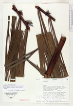
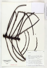
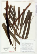
| Family | Arecaceae |
| Identification | Prestoea acuminata (Willd.)H.E.Moore |
| Determined by | F.Borchsenius |
| Identification qualifier | |
| Field notes | Clonal, consisting of seven separate trunks, this one 7.2 cm dbh, 11 m high. Midrib maroon toward base. Inflorescence borne on trunk approx. 1.5 m below crown, Petiole 65 cm, blade 245 cm, 38 leaflets per side. Inflorescence red tinged, composed of many s |
| |
 Other records of Prestoea acuminata Other records of Prestoea acuminataThe map displays only records from the Aarhus Herbarium Database. The records may not represent the full distribution of Prestoea acuminata |
| New Search Modify Search |