AAU Herbarium Database |
| New Search Modify Search |
| Collector | Bergmann, B. |
| Number | 97831 |
| Collected with | Pedersen, H. B. |
| Country | Ecuador |
| Subpart | NAPO |
| County | |
| Locality | Rio Tibutini, 2 1/2 h upstream from Via Auca, left side of the river. Primary forest. |
| Coordinates | 0° 44' S 76° 56' W |
| Minimum elevation (m) | 370 |
| Maximum elevation (m) | 370 |
| Start date | 1991/07/21 |
| End date | 1991/07/23 |
| Family | Arecaceae |
| Identification | Geonoma macrostachys var. macrostachys Mart. |
| Determined by | F. Borchsenius |
| Identification qualifier | |
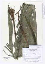
| Field notes | Solitary, acaulecent palm, 1.5 m tall. Leaves 14; sheath and petiole 27 cm long; rachis 85 cm long; lamina entire, 115 cm long, 33 cm wide, apex bifid. Inflorescence spicate; peduncle 35 cm long; spike 27 cm long, 1.4 cm in diam., green-brown. Dubl.: AAU, QCA. |
| |
| Display all 220 georeferenced records of Geonoma Geonoma macrostachys var. macrostachys |
| New Search Modify Search |