AAU Herbarium Database |
| New Search Modify Search |
| Collector | Bergmann, B. |
| Number | 97826 |
| Collected with | Pedersen, H. B. |
| Country | Ecuador |
| Subpart | NAPO |
| County | |
| Locality | Rio Tibutini, 2 1/2 h upstream from Via Auca, left side of the river. Primary forest. |
| Coordinates | 0° 44' S 76° 56' W |
| Minimum elevation (m) | 370 |
| Maximum elevation (m) | 370 |
| Start date | 1991/07/21 |
| End date | 1991/07/23 |
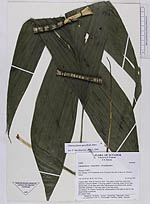
| Family | Arecaceae |
| Identification | Chamaedorea pauciflora Mart. |
| Determined by | Borchsenius, F. (AAU), 1996. |
| Identification qualifier | |
| Field notes | Solitary palm. Stem 20 cm long, diam 1 cm, green, rough from numerous leafscars. Leaves 6; sheath 17 cm long; petiole 13 cm long; rachis 28 cm long; lamina entire, 43 cm long, apex bifid. Inflorescences several per node, spicate, interfoliar; peduncle 17 cm long; spike 11 cm long, green. According to Sr. Ernesto Tseremp the inflorescences of this palm is used by the shuar females as perfume. NV (shuar) Yaun |
| |
| Display all 97 georeferenced records of Chamaedorea Chamaedorea pauciflora |
| New Search Modify Search |