AAU Herbarium Database |
| New Search Modify Search |
| Collector | Bergmann, B. |
| Number | 62185 |
| Collected with | Pedersen, H. B. |
| Country | Ecuador |
| Subpart | PICHINCHA |
| County | |
| Locality | Along dirt-road 5 km above the village of Tandapi on the other side of the Río Toachi. Disturbed primary forest on steep slopes. |
| Coordinates | 0° 25' S 78° 48' W |
| Minimum elevation (m) | 1700 |
| Maximum elevation (m) | 1700 |
| Start date | 1988/05/11 |
| End date | 1988/05/11 |
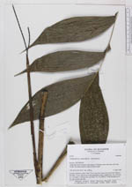
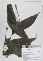
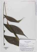
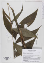
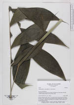
| Family | Arecaceae |
| Identification | Chamaedorea pinnatifrons (Jacq.)Oerst. |
| Determined by | |
| Identification qualifier | |
| Field notes | Solitary understory palm. Stem 72 cm long from base to the lower leaf. Diam of the stem 1.3 cm. Stem green with conspicuous nodes, bamboo-like. No. of leaves 4 + 1 juvenile. 1 inflorescence infrfoliar. No. of rachillae 2. Both rachillae are of the same length and erect. |
| |
| Display all 228 georeferenced records of Chamaedorea Chamaedorea pinnatifrons |
| New Search Modify Search |