AAU Herbarium Database |
| New Search Modify Search |
| Collector | Bergmann, B. |
| Number | 62178 |
| Collected with | Pedersen, H. B. |
| Country | Ecuador |
| Subpart | MANABI |
| County | |
| Locality | National park Macalilla 10 km SE of Agua Blanca. Semi moist forest on slopes. |
| Coordinates | 1° 40' S 80° 37' W |
| Minimum elevation (m) | 37 |
| Maximum elevation (m) | 80 |
| Start date | 1988/05/01 |
| End date | 1988/05/01 |
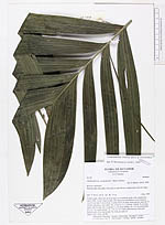
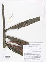
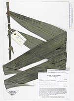
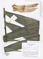
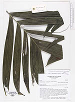
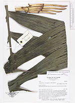
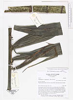
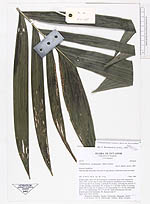
| Family | Arecaceae |
| Identification | Chamaedorea linearis (Ruiz & Pav.)Mart. |
| Determined by | Borchsenius, F. (AAU), 1996. |
| Identification qualifier | |
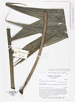
| Field notes | Solitary palm. Stem 610 cm from base to crownshaft, green with conspicuous nodes. Dbh. 5.4 cm. Base of stem with numerous adventitious roots forming a cone 65 cm tall 35 cm in diam. Leafsheath 83 cm long, encircling the stem for 75 cm thus forming a crownshaft. No. of leaves 5 + 1 juvenile. Petiole 15 cm long, rachis 148 cm long. No. of pinnae 2 x 26. Basal pinnae: 41 x 23 cm, mid pinnae: 69 x 9.1 cm, apical pinnae: 24 x 5.4 cm. No visible inflorescences but nuds beneath each of the leafsheaths. No. buds per node 13. Dupl.: AAU, QCA, QCNE. |
| |
| Display all 110 georeferenced records of Chamaedorea Chamaedorea linearis |
| New Search Modify Search |