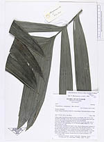
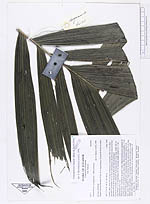
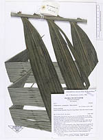
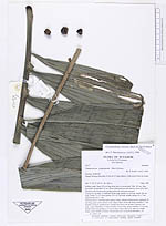
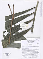
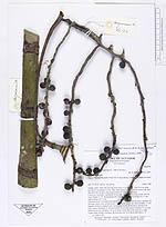
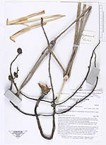
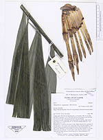
| Field notes | Solitary palm. Stem 430 cm long from base to crownshaft. Dbh. 6.0 cm, diam. just below crownshaft 5.4 cm. Stem with numerous adventitious roots at the base and from 140 cm above the ground where the stem was damaged. Leavea 4+1 juvenile. Leafsheath 59 cm long, petiole 14 cm long, rachis 144 cm long. Pinnae 2 x 23. Basal pinnae 39 x 4.1 cm erect, middle pinnae 62 x 7 cm, apical pinnae 26 x ? cm. Infructescences: 3 inserted at the apical 3 nodes. Mature infructescence: peduncle 38 cm long, green, cross section ovate, largest diam. below the basal rachillae 1.7 cm. Number of bracts: prophyll and 5 peduncular bracts, all deciduos. Rachis 6 cm long, green. Rachillae: 8. Basal rachillae 34 cm long, apical rachillae 31 cm long. Mature fruits red, globular, 1.9 cm in diam. Fruits said to be eaten by a small rodent called Ardilla (Antonio). Kromosome test: m. hydroxychinoline n. 23 m. clark n. 28 |