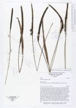
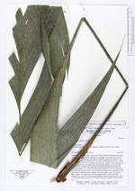
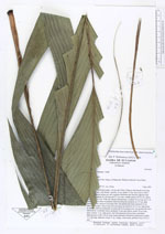
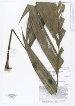
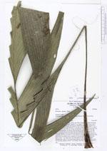
| Field notes | Acaulescent understory palm, 150 cm tall. With 12 leaves, leaf sheath encircling the stem at base, leaf sheath + petiole 34 cm, rachis 73 cm, most leaves with 3 somewhat falcate pinnae per side regularly distributed and inserted opposite each other, basal pinnae 45 cm long and 5.5 cm wide, middle pinnae 46 X 6 cm, apical pinnae 36 X 9.5 cm. With one spicate inflorescence; prophyl 14 cm long and 1 cm wide, inserted at base of peduncle and encircling the peduncle for 9.5 cm, light green to brown, furrowed and paper-like; first peduncular bract inserted 0.5 cm above the prophyl, 28 cm long and encircling the peduncle for 22 cm, light green to reddish, furrowed and partly covered with brown pubescens; first peduncular bract followed by 4 scalelike bracts; peduncle 16 cm and yellow; rachis 18 cm long, diam. at base: 1 cm, light green, and with numerous flower buds embedded. Infructescence with a 34 cm long orange peduncle with brown pubescence; rachis 15.5 cm long, diameter at base 1 cm, orange, with nearly globular fruits (0.8 X 1 cm). |