AAU Herbarium Database |
| New Search Modify Search |
| Collector | Bergmann, B. |
| Number | 62127 |
| Collected with | Pedersen, H. B. |
| Country | Ecuador |
| Subpart | NAPO |
| County | |
| Locality | Eastern side of Rio Yasuni, a little north of the outlet of Laguna Jatunsacha. Primary forest on terra ferme. |
| Coordinates | 0° 59' S 75° 27' W |
| Minimum elevation (m) | 250 |
| Maximum elevation (m) | 250 |
| Start date | 1987/02/25 |
| End date | 1987/02/25 |
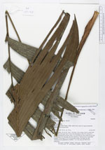
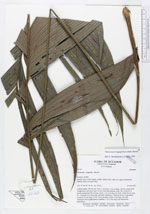
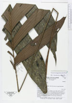
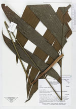
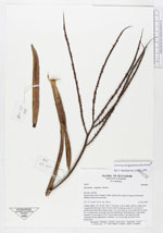
| Family | Arecaceae |
| Identification | Geonoma longepedunculata Burret |
| Determined by | Borchsenius, F. (AAU), 1996. |
| Identification qualifier | |
| Field notes | Solitary palm, 130 cm tall. Stem 7 cm long, 2 cm in diam., brown, rough from conspecious leaf scars, base of stem with adventitious roots. No. of leaves 9; sheath and petiole 80 cm long, basal 1 cm encircling the stem; rachis 40 cm long; No. of pinnae 4 to 5 per side, unevenly distributed. Inflorescences 3, interfoliar; peduncle 31 cm long, 0.3 X 0.4 cm in diam; rachis 4 cm long, red with cinnamon-brown pubescence; rachillae 7, to 23 cm long, red with brown pubescence. |
| |
 Other records of Geonoma longepedunculata Other records of Geonoma longepedunculataThe map displays only records from the Aarhus Herbarium Database. The records may not represent the full distribution of Geonoma longepedunculata |
| New Search Modify Search |