| Collector | Klitgaard, B. B. |
| Number | 514 |
| Collected with | P. Lozano, T. Delgado, N. Aguirre, R. Tapia & H. Alejandro |
| Country | Ecuador |
| Subpart | EL ORO |
| County | |
| Locality | Bosque Petrificado Puyango. Dirt track from information centre towards the forest. |
| Coordinates | 3° 52' S 80° 5' W |
| Minimum elevation (m) | 450 |
| Maximum elevation (m) | 450 |
| Start date | 1997/05/07 |
| End date | 1997/05/07 |
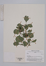
| Family | Rubiaceae |
| Identification | Randia |
| Determined by | |
| Identification qualifier | |
| Field notes | Degraded primary dry forest. Left side of quebrada near rock pools. Multiple-stemmed, spiny shrub to 4 m. Cortex greyish. Leaves dark green abov, fresh green below. Seeds black. |
|