| Collector | Klitgaard, B. B. |
| Number | 358 |
| Collected with | P. Lozano, N. Aguirre & I. Aldaz |
| Country | Ecuador |
| Subpart | ZAMORA-CHINCHIPE |
| County | |
| Locality | Footpath to Rio San Francisco (towards Parque Nacional Podocarpus) off new road Loja-Zamora, km 23-24 |
| Coordinates | 3° 58' S 79° 5' W |
| Minimum elevation (m) | 2100 |
| Maximum elevation (m) | 2100 |
| Start date | 1996/09/26 |
| End date | 1996/09/26 |
| Family | Alstroemeriaceae |
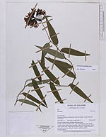
| Identification | Bomarea distichifolia (Ruiz & Pav.) Baker |
| Determined by | Hofreiter, T. (K), 2003; Hofreiter (MSB) 2006 |
| Identification qualifier | |
| Field notes | "Humid montane forest. Herb to 40 cm. Calyx green; tepals scarlet. Fruit orange. Scattered." |
|
 Other records of Bomarea distichifolia