| Collector | Stein, B.A. |
| Number | 2869 |
| Collected with | |
| Country | Ecuador |
| Subpart | Napo |
| County | |
| Locality | Trail to La Bonita c. 1 to 2 km from end of Tulcan-Sta. Barbara road, c. 25 km below Sta. Barbara. |
| Coordinates | 0° 35' N 77° 30' W |
| Minimum elevation (m) | 2100 |
| Maximum elevation (m) | 2150 |
| Start date | 1985/05/28 |
| End date | 1985/05/28 |
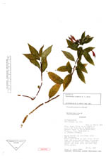
| Family | Campanulaceae |
| Identification | Centropogon pygmaeus B. A. Stein |
| Determined by | |
| Identification qualifier | |
| Field notes | Cloud forest and clearings above Rio Chingual. Erect herb 20-40 cm tall along forest edge and trailside through clearings; corolla cardinal red, erect; anther purple and gray; stem and some leaf veins purple. |
|
 Other records of Centropogon pygmaeus