AAU Herbarium Database |
| New Search Modify Search |
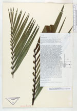
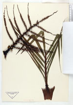
| Collector | Barfod, A.S. |
| Number | 60167 |
| Collected with | |
| Country | Ecuador |
| Subpart | LOJA |
| County | |
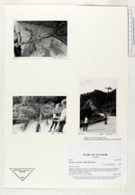
| Locality | Yangana-Valledolid road km 15 just before arriving at Podocarpus National Park. Dense montane forest on slope. Spring area with sphagnum mosses covering the ground, ca 2500 m. |
| Coordinates | 4° 27' S 79° 10' W |
| Minimum elevation (m) | 2500 |
| Maximum elevation (m) | 2500 |
| Start date | 1987/01/21 |
| End date | 1987/01/21 |
| Family | Arecaceae |
| Identification | Prestoea acuminata var. acuminata (Willd.)H.E.Moore |
| Determined by | A. Henderson |
| Identification qualifier | |
| Field notes | |
| |
| Display all 36 georeferenced records of Prestoea Prestoea acuminata var. acuminata |
| New Search Modify Search |