AAU Herbarium Database |
| New Search Modify Search |
| Collector | Henderson, A. |
| Number | 39 |
| Collected with | |
| Country | Venezuela |
| Subpart | Amazonas |
| County | |
| Locality | Dpto. Río Negro. Neblina Base Camp. Rio Mawarinuma. |
| Coordinates | 0° 50' N 66° 1' W |
| Minimum elevation (m) | 140 |
| Maximum elevation (m) | 140 |
| Start date | 1984/03/08 |
| End date | 1984/03/08 |
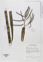
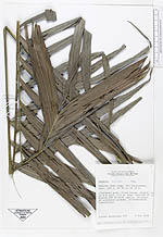
| Family | Arecaceae |
| Identification | Geonoma maxima (Poit.)Kunth |
| Determined by | Borchsenius, F. |
| Identification qualifier | |
| Field notes | Clustered palm. Stems brown, ringed up to 3 m tall, 2,5 cm diam. Petiole 50 cm. Rachis 100 cm with approx. 20 pairs of alternate pinnae. Inflorescence infrafoliar. |
| |
 Other records of Geonoma maxima Other records of Geonoma maximaThe map displays only records from the Aarhus Herbarium Database. The records may not represent the full distribution of Geonoma maxima |
| New Search Modify Search |