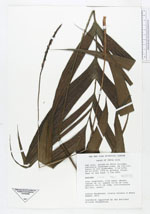
| Collector | Henderson, A. |
| Number | 1803 |
| Collected with | Galeano, G.; Hammel, B. |
| Country | Costa Rica |
| Subpart | San Jose |
| County | |
| Locality | Cantón de Pérez Zeledón, Carretera Interamericana, km 115 - 116, basin of Río Quebradas. Primary forest next to the road. |
| Coordinates | 9° 28' 40'' N 83° 41' 25'' W |
| Minimum elevation (m) | 1750 |
| Maximum elevation (m) | 1750 |
| Start date | 1992/06/04 |
| End date | 1992/06/04 |
| Family | Arecaceae |
| Identification | Geonoma cuneata H. Wendl. ex Spruce |
| Determined by | Borchsenius, F. |
| Identification qualifier | |
| Field notes | Stem cespitose, with basal shoots. Leaves ca 12; sheath 13 - 26 long; petiole 28 - 31 cm long. Inflorescence spicate, erect. |
|