AAU Herbarium Database |
| New Search Modify Search |
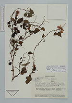
| Collector | Freire, A. |
| Number | 565/AA |
| Collected with | et al. |
| Country | Ecuador |
| Subpart | Pichincha |
| County | |
| Locality | Valle del Lloa y Palmira. Faldas SO del Volcán Pichincha 20-29 km del carretero Quito-Lloa-Mindo. Vegetación de bosque nublado y Andino. Área lluviosa con suelo humífero. Géneros representativos: Cedrela, Miconia, Eugenia, Buddleja, Solanum, Saurauia, Oreopanax, etc. |
| Coordinates | 0° 12' S 78° 39' W |
| Minimum elevation (m) | 2500 |
| Maximum elevation (m) | 3000 |
| Start date | 1987/04/26 |
| End date | 1987/04/26 |
| Family | Begoniaceae |
| Identification | Begonia maurandiae A. DC. |
| Determined by | Mark C. Tebbit |
| Identification qualifier | |
| Field notes | Yerba trepadora; tépalos rojos claros, creciendo como epífita de Baccharis latifolia, junto a Phyllanthus. |
| |
 Other records of Begonia maurandiae Other records of Begonia maurandiaeThe map displays only records from the Aarhus Herbarium Database. The records may not represent the full distribution of Begonia maurandiae |
| New Search Modify Search |