| Collector | Fay, A. |
| Number | 3327 |
| Collected with | L.Fay |
| Country | Ecuador |
| Subpart | Pichincha |
| County | |
| Locality | Canton Quito. Río Guajalito Reserve. 10 km W of Chiriboga, km 59 of old road Quito- Santo Domingo. Wet Cloud Forest. |
| Coordinates | 0° 14' S 78° 48' W |
| Minimum elevation (m) | 1900 |
| Maximum elevation (m) | 1900 |
| Start date | 1991/07/10 |
| End date | 1991/07/10 |
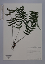
| Family | Aspleniaceae |
| Identification | Asplenium palulahuae Sodiro |
| Determined by | R.C.Moran |
| Identification qualifier | |
| Field notes | Epiphyte. Alate stipe. Fronds to 60 cm. |
|
 Other records of Asplenium palulahuae