AAU Herbarium Database |
| New Search Modify Search |
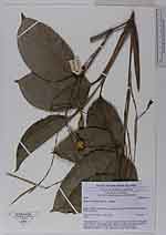
| Collector | Poulsen, A.D. |
| Number | 2476 |
| Collected with | Kevin Johns Ruhumane & Ataban Uia |
| Country | Solomons Islands |
| Subpart | |
| County | |
| Locality | Makira Island. Trail (former ligging road) between Warito and Bonpusu. Edge of garden |
| Coordinates | 10° 29' S 161° 54' E |
| Minimum elevation (m) | 250 |
| Maximum elevation (m) | 250 |
| Start date | 2006/11/26 |
| End date | 2006/11/26 |
| Family | Marantaceae |
| Identification | Donax canniformis Schum. |
| Determined by | |
| Identification qualifier | |
| Field notes | Terrestrial herb to 1.5 m tall, in clump. Flowers white. Fruit round, pale green. Planted. Vernacular name: aparawowo (Bauro language; used for tying the sago palm roof elements and for making fish traps) |
| |
| Display all 38 georeferenced records of Donax Donax canniformis |
| New Search Modify Search |