AAU Herbarium Database |
| New Search Modify Search |
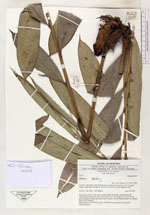
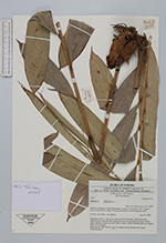
| Collector | Poulsen, A.D. |
| Number | 2137 |
| Collected with | Abia Daniel |
| Country | Indonesia |
| Subpart | East Kalimantan |
| County | |
| Locality | Langap Concession Area. Logged forest. Open area at edge of erosion area above recent logging road |
| Coordinates | 3° 5' N 116° 34' E |
| Minimum elevation (m) | 600 |
| Maximum elevation (m) | 600 |
| Start date | 2003/08/29 |
| End date | 2003/08/29 |
| Family | Zingiberaceae |
| Identification | Etlingera (Blume)R.M.Sm. |
| Determined by | A.D. Poulsen |
| Identification qualifier | |
| Field notes | Terrestrial herb, 1.5 m, loose clumb. Base brownish, sheath greenish. Inflorescence near the base, bracts brown to red: bright red at top. Petals pink, labellum bright red with yellow center, +/- bifid. Stamen pale red. Stigma dark red. Tasteless |
| |
| Display all 28 georeferenced records of Etlingera Etlingera |
| New Search Modify Search |