| Collector | Carretero, A. C. |
| Number | 1708 |
| Collected with | M. Paredes and R. Lozano |
| Country | Bolivia |
| Subpart | Chuquisaca |
| County | |
| Locality | Provincia Sud Cinti, Culpina. Cañon Verde, sector Las Abras. Quebrada Pirhua. Bosque montano semihúmedo al borde de quebrada |
| Coordinates | 21° 5' 35.3'' S 64° 14' 39.3'' W |
| Minimum elevation (m) | 1170 |
| Maximum elevation (m) | 1170 |
| Start date | 2005/05/22 |
| End date | 2005/05/22 |
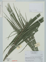
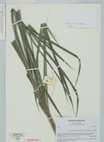
| Family | Arecaceae |
| Identification | Ceroxylon pityrophyllum Mart. ex H.Wendl. |
| Determined by | |
| Identification qualifier | ? |
| Field notes | Palma de 3 m de altura. Inflorescencia interfoliar, hojas de 2 m de largo y peciolo sin espinas. Alimento, forraje y rituales |
|
 Other records of Ceroxylon pityrophyllum