| Locality | Prefecture Fenoarivo Atsinanana, Sub-prectureVavatenina, Vatovelona forest, ca. 10 km south of the village Manakambahiny 1, Zahamena strict nature reserve (Réserve Naturelle Intégrale), closed forest with undergrowth, medium slope |
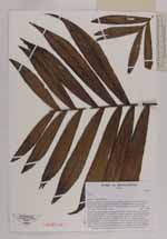
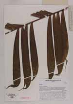
| Field notes | Solitary tree; trunc straight, unarmed, 10 m high; internodes 10 cm; dbh 3.8 cm; leaves neatly abscicing; crownshaft 20 cm long, cream white at base and pale green in other parts; petiole 20 cm long, round, green with brown scales; rachis 70 cm long; leaves pinnate, reduplicate, arranged in groups of 3 - 4 pinnae, distance between groups 7 cm, central pinnae 20 cm long, 4 cm wide; uses: stem formerly used to make blowdart pipes for hunting purposes; nowadays the stem is used as travers roof beams to attach the thatching and as wall beams; local name: Sinkiara |
 Other records of Dypsis