| Locality | Prefecture Fenoarivo Atsinanana, Sub-prectureVavatenina, Ambinany Namantoana forest, ca. 10 km south-southwest of the village Manakambahiny 1, Zahamena national park, closed forest with undergrowth, medium slope. |
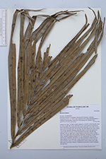
| Field notes | Solitary tree; trunc 7 m high, straight, unarmed, covered by old leaf sheaths along the whole length; dbh 19 cm; internodes 15 cm; wood consists of outer brown layer followed by a thin black layer and yellow-white pith; crown with 12 leaves, marcescent; leaf sheath open, 100 cm long, with many light brown scales; petiole 230 cm long, adaxially channeled, abaxially round, covered with light brown scales; rachis 520 cm long, covered with light brown scales, abaxially flat, adaxially with two ridges and a central channel in the basal sections, in distal parts with a single ridge; leaves pinnate, reduplicate, 100 pinnae on each side of rachis, regularly arranged at distance of 5 cm, central pinnae 140 cm long; inflorescence infrafoliar, branched to 1st order, 60 branches which are 40 cm long; peduncle 150 cm long; uses: young, unopened leaves uses for weaving (hats, decorative mats, etc.), fully expanded leaves used to thatch roofs, palm heart eaten; local name: Lakatra or Lakablonona (the latter is used to designate the male tree) |
 Other records of Ravenea lakatra