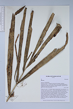
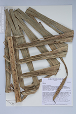
| Locality | Prefecture Fenoarivo Atsinanana, Sub-prectureVavatenina, Ambinany Namantoana forest, ca. 10 km south-southwest of the village Manakambahiny 1, Zahamena strict nature reserve (Réserve Naturelle Intégrale), closed forest with undergrowth, gentle slope leading down to river. |
| Field notes | Solitary tree, trunc 3 - 10 m high, straight, unarmed; dbh 14 cm; internodes 5 - 10 cm wide, curved; crown with 10 - 15 leaves; leaf sheath open, 60 cm long, 15 - 20 cm wide, green with brown scales; petiole absent; rachis 410 cm long, green, abaxial side round, adaxial side channeled basally, with two ridges and a central channel in distal parts; leaves pinnate reduplicate, 72 pinnae on each side of rachis, regularly arranged, central pinnae 90-100 cm long; inflorescence interfoliar, branched to 1st order, 50 branches, which are 35 cm long; total inflorescence length 70 cm; peduncle flattened, fibrous, 35 cm long, 3 cm wide; prophyl 70 cm long; uses: palm heart eaten; local names: Hovotsarorona or Hovojavavy. |
 Other records of Ravenea