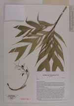
| Locality | Prefecture Fenoarivo Atsinanana, Sub-prectureVavatenina, Vatovelona forest, ca. 10 km south of the village Manakambahiny 1, buffer zone for the Zahamena strict nature reserve (Réserve Naturelle Intégrale), protected area with controlled extraction of forest products, closed forest with undergrowth, medium slope near river bank next to small foot path |
| Field notes | Solitary small palmlet, part of undergrowth, stem 1.5 m high, straight, unarmed, yellow-green; diameter 0.3 cm; internodes 2 cm; leaf scars brown, few mm wide; crown with 10 leaves, marcescent; crownshaft green to yellow with brown scales, 8 cm long; petiole 1.5 cm - 2.0 cm long, adaxially green, abaxially yellow to green; rachis 15 - 20 cm long, green; leaves pinnate, broadly inserted leaflets, 4 pairs of leaflets, arranged regularly, leaflet size variable, on average 7 - 8 cm long, 3 - 4 cm wide; inflorescence interfoliar, branched to 2nd order but mostly only 1st order branches, 10 - 15 branches which are 4 - 5 cm long, total inflorescence lenght 20 cm; peduncle green, 12 cm long; peduncular bracts 8 cm long; fruits green, 1.0 cm long, 0.5 cm wide, three small petals remain attached, inside consists of white ruminate mass. |
 Other records of Dypsis