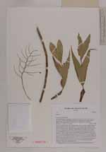
| Locality | Prefecture Fenoarivo Atsinanana, Sub-prectureVavatenina, Vatovelona forest, ca. 10 km south of the village Manakambahiny 1, Zahamena strict nature reserve (Réserve Naturelle Intégrale), closed forest with undergrowth, steep slope |
| Field notes | Clustering small palmlet, part of undergrowth; stem 1 m high, straight, upright or leaning, diameter 0.5 cm; internodes 0.7 - 1.5 cm wide, green to yellow; crown with 5 - 10 leaves, neatly abscicing; crownshaft 4 cm long, brown, fibrous inside; petiole 1 cm long, green with brown scales, rachis 15 cm long; leaves pinnate, pinnae arranged in pairs of two leaflets on opposite sides of the rachis, terminal pinnae with "bitten" edges; inflorescence interfoliar, green, branched to 2nd order, 10 - 15 1st order branches, peduncle 8 cm long, flattened, green, total inflorescence length 15 cm; flower buds threelobed, yellow-green, 1 mm across; fruits bright red when ripe, round to ellipsoid, diameter 1.0 cm; seed coat yellow with light brown stripes, seed homogenous white inside; uses: leaves used as ointment against skin disorders, either by directly applying the leaves or by extracting oil through fumigation; local name: Sinkiaramboalavo |
 Other records of Dypsis